
Photo credit Tom Raftery
We last wrote about the Eye on Earth site in July 2008. If you can’t remember that far back, a quick recap – Microsoft and the European Environmental Agency (EEA) signed a non-exclusive five year deal with a goal to make environmental information more accessible to citizens in Europe.
EyeOnEarth, the first product of that agreement was launched on July 30th 2008 as a site listing water bathing quality for beaches and waterways throughout Europe. What was unique about the site was that it contained historical data going back as far as 1991 as well as the ability for anyone browsing the site to give their own feedback on beaches/waterways. A superb way to capture and present grassroots water quality data.
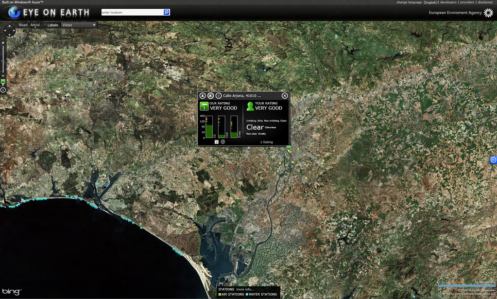
In the last couple of weeks, there have been major changes to the EyeOnEarth website. The site has been moved to Microsoft’s new cloud computing services platform Windows Azure, and data from 6,000 air quality monitoring stations across Europe is now also included in the site. The air quality data includes information on ozone, particulate matter (PM10) and nitrogen dioxide (NO2) but, curiously, doesn’t include sulphur dioxide (SO2) or carbon dioxide (CO2).
The site has now been combined with Bing Maps and Silverlight controls which work quite well once you realise that you have to type in the name of the location you are interested in into the search bar at the top to see any data. Intuitively I initially clicked on air and water stations on the map but this failed to do yield any data. This appears to be a function of your zoom level because once you zoom in far enough, a click on an air or water station will yield the information.
The fact that the site is written in Silverlight is disappointing as the number of computers with Silverlight installed is somewhere between 32% and 47%. There is a non-Silverlight version of the site available but I failed to get this to work either on my Vista PC or on my iPhone.
The lack of a working platform for mobile is a big disappointment, frankly. Back in 2008 Microsoft’s Director EU & NATO, reassured me that:
We haven’t tested or adapted the site for mobile access now due to time constraints but mobile access is a core component of our vision for the Observatory portal as we like to offer an alerting/subscription service
I took this to mean that there would be a mobile version of the site developed.
However, what Microsoft and the EEA have now delivered is an SMS service whereby you can text a command to a UK number (+44 7786 201 106) – this allows you to receive instant updates on air and water quality for any location in the EEA member countries, however, as far as I can tell there is no way to add data to the site from your mobile, something I’d be very keen to do if I had the option.
The addition of the air quality data to Eye on Earth is a very welcome development, however making the site less accessible, and not having a mobile version of the site means that this update of the site would appear to be a case of one step forward and two steps back.
UPDATE: Just thinking now that if there were an api to this data and if it were geotagged, it would make a really interesting Augmented Reality Layar for a mobiles.